University of Virginia researchers are developing a flexible online tool for navigating information used in the fight to save children from deadly diarrheal diseases by identifying transmission hotspots and accelerating the deployment of treatments and new vaccines.
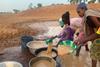
Diarrhea not only kills hundreds of thousands of children around the world every year, it contributes to malnutrition that can prevent kids from growing and developing to their full potential both physically and mentally, trapping them in poverty. While significant progress has been made against the disease in recent years, the UVA researchers say that the modern era of “big data” offers a vast untapped opportunity to respond more nimbly and help more children.
Their Planetary Child Health & Enterics Observatory (Plan-EO) is bringing together the expertise of epidemiologists, climatologists, bioinformaticians and hydrologists (water supply experts) to provide an unprecedented, big-picture view of diarrhea around the world. The information and predictions that these experts come up with, will be hosted in a map-based online portal, giving infectious disease experts and local leaders in low- and middle-income countries the information they need to make smart decisions, prioritize resources and move quickly to save lives.
Great unmentionable
“Diarrhea is very much the great unmentionable public health threat, often ignored or seen as an unavoidable experience of childhood. We want to change that,” said epidemiologist Josh M. Colston, PhD, an assistant professor in the UVA School of Medicine’s Division of Infectious Diseases and International Health, who is leading the initiative.
“As patterns of infectious diarrheal diseases shift due to climate change, we want the public health community to be ready and have all the most up-to-date epidemiological estimates and predictions at their fingertips.”
To build out the new online dashboard, Colston is collaborating with experts in UVA’s School of Engineering, School of Data Science and Biocomplexity Institute, as well as colleagues at Johns Hopkins University. They are taking a multidisciplinary approach to a complex problem, seeking to capitalize on a vast array of expertise and build on longstanding relationships with collaborators overseas.
Climate change impact
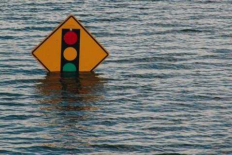
The researchers say that as climate change accelerates, the need to track diarrhea’s spread is only increasing. Flooding, for example, can help spread dozens of bacteria, viruses and parasites that cause diarrhea, worsening the situation in areas already reeling from the effects of the weather. That’s why it’s important for UVA’s project to include hydrologists, climatologists and experts in areas that go beyond infectious disease, the researchers say.
“Awareness is really growing that diseases have multi-faceted risk factors that encompass environmental, social and behavioral elements. We saw that with the pandemic, and we certainly see it with diarrheal diseases. That’s why a collaborative approach is crucial,” said Margaret Kosek, MD, professor of medicine and an infectious diseases clinician. “We’re fortunate here at UVA to have experts in all these aspects all on the same grounds, as well as the support to bring them together.”
Vital data
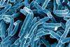
The new online dashboard, now under construction, will be updated continually to provide the latest data on pathogen dynamics, akin to John Hopkins’ invaluable COVID-19 dashboard during that pandemic. Visitors to the Plan-EO site will be directed to a world map-based interface where they can select data on specific diarrhea-causing pathogens, such as E. coli or Shigella bacteria.
The dashboard will allow researchers and leaders to understand the magnitude of the disease burden and predict the potential implications for the children living in endemic areas. It will also allow infectious disease experts and local leaders to coordinate the best strategies for responding to and containing the outbreaks, ultimately saving lives.
“Let’s say you’re an epidemiologist in Africa or South Asia and you’re interested in a specific community in a particular country to carry out a water-improvement project or vaccine trial,” said Venkat Lakshmi, hydrologist and John L Newcomb Professor of Engineering in Civil and Environmental Engineering. “Using the Plan-EO interface, you’ll be able to navigate to that location on a map and get robust predictions of the prevalence of particular pathogens, as well as published information on studies that have been carried out in the surrounding areas. It’ll be a gamechanger.”
The researchers plan to launch the dashboard later this year, with assistance from capstone students at the UVA School of Data Science.
Findings published
The researchers have described their ambitious project in the scientific journal PLOS One. The research team consists of Colston, Bin Fang, Eric Houpt, Pavel Chernyavskiy, Samarth Swarup, Lauren M. Gardner, Malena K. Nong, Hamada S. Badr, Benjamin F. Zaitchik, Lakshmi and Kosek. The researchers have no financial interest in the project.
The work is being supported by the National Institutes of Health’s National Institute of Allergy and Infectious Diseases, grants 1K01AI168493-01A1 and 1R03AI151564-01; the National Science Foundation, Expeditions in Computing grant CCF-1918656; NASA’s Group on Earth Observations Work Programme, grant 16-GEO16-0047; and UVA’s Engineering in Medicine program, Department of Internal Medicine and Division of Infectious Diseases and International Health. Additional funding was provided by the Bill & Melinda Gates Foundation, grant OPP1066146.
Topics
- University of Virginia
- Clean Water
- Climate Action
- diarrheal diseases
- Epidemiology
- Future Technologies
- Infection Prevention & Control
- Infectious Disease
- Josh M. Colston
- Margaret Kosek
- One Health
- Plan-EO
- Planetary Child Health & Enterics Observatory
- Public Health
- Research News
- Sample preparation, filtration, detection and treatment techniques for water-borne pathogens
- USA & Canada
- Venkat Lakshmi


No comments yet